Urla (Urla)
Urla district area's eastern end neighbors the westernmost district of the Greater Metropolitan Area of İzmir, Güzelbahçe, and urbanization is much denser across that part, contributing to the whole district's average urbanization rate of 75%. With İzmir center (Konak) at a distance of only 35 km, an important part of Urla's population is composed of residents, often wealthy, who commute to the big city every day, access to and from İzmir and Çeşme, an international center of tourism at a distance of 45 km from Urla, having been greatly facilitated by the building of a six-lane highway. Urla district nevertheless manages to preserve an overall outlook of a pleasant suburb and resort, and as it extends to the west along Karaburun Peninsula, where it borders on the districts of Çeşme and Karaburun, secondary residences built along the coast or large farms of the interior, as well as native villages, all bearing typical Aegean characteristics, increase in number. To the south, Urla district neighbors that of Seferihisar and the settlement pattern is thinner in that section, with even some empty land, although housing projects targeting İzmir's professional classes start to show a rising interest for that section as well. In economic terms, agricultural products, and especially the fresh produce for the vast nearby market of İzmir, occupy a prominent place in Urla's economy, with fish, poultry and flowers standing out.
An international Artichoke Festival is celebrated since 2015.
The name "Urla" is derived from the Greek Βουρλά ("Vourla") meaning marshlands and the town was cited as such in western sources until the 20th century. Bryela (Byzantine name meaning Woman of God i.e. Holy Maria) whereas it has been suggested that due to the transposition of vowels Bryela has become Vourla, meaning marshlands. Urla is where the ancient city of Klazomenai is located and its remains are much visited, while the name lives on in the unofficial appellation used in the region for part of the coastline of the district, "Kilizman" which is a still-used derivative of Klazomenai. (Former name of Güzelbahçe). With literacy among the highest in Turkey at 97%, Urla is also home to İzmir Institute of Technology. Urla prides itself for having raised two important men of letters, Giorgos Seferis and Necati Cumalı.
Urla town center is made up by 23 officially constituted and delimited quarters. Among these, the neighborhoods located on the coastline, such as İskele and Zeytinalanı quarters, play a key role in the town's pace, especially as places of gathering. The district counts 14 villages. Since the building of the highway, the population increases at a regular rate of 4 per cent a year, although the district is still placed in the lower end of ranking of İzmir's districts on the basis of their population.
Map - Urla (Urla)
Map
Country - Turkey
 |
|
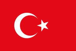
| Flag of Turkey | |
One of the world's earliest permanently settled regions, present-day Turkey was home to important Neolithic sites like Göbekli Tepe, and was inhabited by ancient civilisations including the Hattians, Hittites, Anatolian peoples, Mycenaean Greeks, Persians and others. Following the conquests of Alexander the Great which started the Hellenistic period, most of the ancient regions in modern Turkey were culturally Hellenised, which continued during the Byzantine era. The Seljuk Turks began migrating in the 11th century, and the Sultanate of Rum ruled Anatolia until the Mongol invasion in 1243, when it disintegrated into small Turkish principalities. Beginning in the late 13th century, the Ottomans united the principalities and conquered the Balkans, and the Turkification of Anatolia increased during the Ottoman period. After Mehmed II conquered Constantinople (Istanbul) in 1453, Ottoman expansion continued under Selim I. During the reign of Suleiman the Magnificent, the Ottoman Empire became a global power. From the late 18th century onwards, the empire's power declined with a gradual loss of territories. Mahmud II started a period of modernisation in the early 19th century. The Young Turk Revolution of 1908 restricted the authority of the Sultan and restored the Ottoman Parliament after a 30-year suspension, ushering the empire into a multi-party period. The 1913 coup d'état put the country under the control of the Three Pashas, who facilitated the Empire's entry into World War I as part of the Central Powers in 1914. During the war, the Ottoman government committed genocides against its Armenian, Greek and Assyrian subjects. After its defeat in the war, the Ottoman Empire was partitioned.
Currency / Language
| ISO | Currency | Symbol | Significant figures |
|---|---|---|---|
| TRY | Turkish lira | ₺ | 2 |
| ISO | Language |
|---|---|
| AV | Avar language |
| AZ | Azerbaijani language |
| KU | Kurdish language |
| TR | Turkish language |


